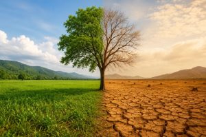
Introduction
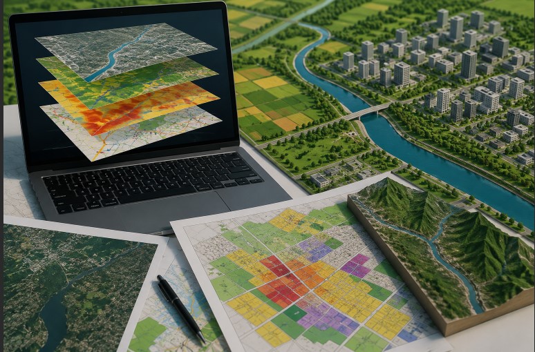
Land use planning plays a major role in shaping sustainable cities, villages, industries, transportation systems, and agricultural regions. As populations continue to grow rapidly, governments and planners require accurate tools to manage land resources effectively. Traditional planning methods often relied on paper maps, manual surveys, and outdated records. However, modern technology has transformed the entire planning process through Geographic Information Systems (GIS) and digital mapping.
GIS and mapping technologies help planners collect, store, analyze, and visualize geographical information with high accuracy. These technologies support decision-making in urban development, environmental conservation, infrastructure planning, disaster management, and resource allocation. Moreover, GIS provides real-time insights that improve planning efficiency and reduce errors.
Modern land use planning focuses on balancing economic growth, environmental protection, and social development. Therefore, GIS has become an essential tool for identifying suitable land for residential, industrial, commercial, agricultural, and recreational purposes. In addition, digital mapping helps governments monitor land changes and prevent unauthorized development.
This article explains the role of GIS and mapping in modern land use planning, including their concepts, components, applications, benefits, and importance in sustainable development.
Understanding GIS in Land Use Planning
Geographic Information System (GIS) is a computer-based technology used to capture, manage, analyze, and display spatial and geographical data. GIS combines maps with data analysis tools to help planners understand relationships between locations, resources, and human activities.
GIS allows planners to visualize information in layers. For example, a planner can analyze roads, rivers, population density, soil type, vegetation, and buildings on separate layers within a single system. As a result, decision-makers gain a complete understanding of an area before implementing development projects.
Basic Components of GIS
Hardware
Hardware includes computers, GPS devices, servers, drones, and data storage systems used to operate GIS software and manage geographical information.
Software
GIS software helps users create maps, analyze spatial data, and generate planning reports. Popular GIS software includes:
- ArcGIS
- QGIS
- GRASS GIS
- MapInfo
- GeoMedia
Spatial Data
Spatial data refers to location-based information collected from:
- Satellite imagery
- Drone surveys
- GPS systems
- Field surveys
- Remote sensing technology
People
GIS specialists, urban planners, environmental experts, surveyors, and government officials operate GIS systems and interpret planning data.
Methods and Procedures
GIS requires proper methods for collecting, processing, updating, and analyzing geographical information.
Importance of Mapping in Land Use Planning
Mapping is one of the most important aspects of land use planning. Accurate maps help planners identify existing land conditions and future development opportunities.
Modern digital mapping systems provide detailed geographical representations that improve planning accuracy. Furthermore, mapping technologies help reduce conflicts related to land ownership, zoning, and infrastructure development.
Types of Maps Used in Land Use Planning
Topographic Maps
These maps show elevation, terrain, slopes, rivers, and natural features. They help planners identify suitable construction areas.
Land Use Maps
Land use maps classify areas into categories such as:
- Residential
- Commercial
- Industrial
- Agricultural
- Forest land
- Recreational zones
Zoning Maps
Zoning maps regulate how land can be used in different regions.
Transportation Maps
These maps display roads, railways, airports, and transportation networks.
Environmental Maps
Environmental maps help monitor forests, wetlands, wildlife habitats, and pollution-sensitive zones.
Cadastral Maps
Cadastral maps show land ownership boundaries and property divisions.
Evolution of GIS and Mapping Technologies
GIS technology has evolved significantly over the past few decades. Earlier planning systems relied on manual drafting and paper records. These methods consumed time and often produced inaccurate results.
Today, digital GIS platforms use advanced technologies such as:
- Remote sensing
- Artificial intelligence
- GPS integration
- Drone mapping
- Cloud computing
- Big data analytics
As technology continues to improve, planners can now access real-time spatial information for faster decision-making.
Traditional Mapping vs Modern GIS Mapping
| Traditional Mapping | Modern GIS Mapping |
|---|---|
| Paper-based maps | Digital interactive maps |
| Manual updates | Real-time updates |
| Limited analysis | Advanced spatial analysis |
| Time-consuming | Faster processing |
| Difficult storage | Cloud-based storage |
| Lower accuracy | High precision data |
Modern GIS systems therefore provide greater efficiency and reliability in land use planning.
Role of GIS in Urban Land Use Planning
Urbanization is increasing rapidly across the world. Cities face major challenges related to housing, traffic congestion, pollution, water supply, and infrastructure development. GIS helps urban planners manage these challenges effectively.
Site Selection for Urban Development
GIS helps planners identify suitable locations for:
- Housing projects
- Commercial complexes
- Educational institutions
- Hospitals
- Public utilities
Planners analyze factors such as:
- Population density
- Accessibility
- Water availability
- Flood risk
- Environmental impact
As a result, development projects become more organized and sustainable.
Transportation Planning
Transportation planning requires accurate road network analysis. GIS helps planners design efficient transportation systems by analyzing:
- Traffic flow
- Road connectivity
- Public transport routes
- Accident-prone areas
Moreover, GIS supports smart city initiatives by improving urban mobility systems.
Infrastructure Management
GIS assists governments in managing infrastructure such as:
- Water pipelines
- Drainage systems
- Electricity networks
- Sewage systems
- Communication networks
Digital mapping allows authorities to monitor infrastructure conditions and plan maintenance activities efficiently.
Monitoring Urban Growth
Cities expand continuously due to population growth. GIS helps planners monitor urban sprawl and identify unauthorized construction activities.
Satellite imagery combined with GIS enables authorities to compare land use changes over time. Consequently, planners can implement better urban control measures.
GIS in Rural and Agricultural Land Planning
GIS is equally important in rural development and agricultural planning. Farmers and agricultural authorities use GIS to improve productivity and manage land resources effectively.
Soil Analysis and Crop Planning
GIS helps analyze soil properties such as:
- Soil fertility
- Moisture levels
- Nutrient availability
- Soil texture
Based on this information, farmers can select suitable crops for different regions.
Irrigation Management
Water management is critical in agriculture. GIS supports irrigation planning by mapping:
- Water sources
- Canal systems
- Groundwater levels
- Rainfall patterns
This helps optimize water usage and improve agricultural sustainability.
Precision Farming
Precision farming uses GIS and GPS technologies to monitor crop conditions accurately. Farmers can apply fertilizers and pesticides only where needed, reducing waste and increasing efficiency.
Land Capability Assessment
GIS helps determine whether land is suitable for:
- Agriculture
- Forestry
- Grazing
- Construction
This prevents improper land utilization and environmental degradation.
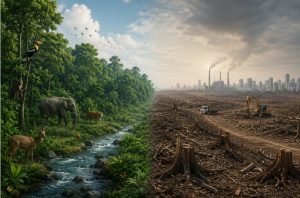
GIS and Environmental Conservation
Environmental protection has become a major priority in land use planning. GIS helps monitor environmental resources and supports sustainable development strategies. Governments, researchers, and planners use GIS technology to protect forests, water bodies, wildlife habitats, and environmentally sensitive regions.
Modern environmental planning depends heavily on accurate geographical information. Therefore, GIS allows authorities to identify ecological threats and implement proper conservation measures before severe environmental damage occurs.
Forest Management Using GIS
Forests are valuable natural resources that support biodiversity, climate balance, and water conservation. GIS helps monitor forest conditions and track changes over time.
GIS applications in forest management include:
- Monitoring deforestation
- Mapping forest cover
- Detecting illegal logging
- Identifying wildlife habitats
- Assessing forest fire risks
Satellite imagery combined with GIS provides real-time updates about forest conditions. Consequently, forest departments can take faster action to protect natural ecosystems.
Wetland and Coastal Zone Protection
Wetlands and coastal regions are environmentally sensitive areas that require careful planning. GIS helps authorities identify vulnerable zones and regulate construction activities in these regions.
GIS supports:
- Coastal erosion monitoring
- Mangrove protection
- Wetland conservation
- Floodplain mapping
- Marine ecosystem analysis
As climate change increases sea-level rise and coastal risks, GIS-based coastal management becomes increasingly important.
Pollution Monitoring and Control
Industrialization and urbanization have increased pollution levels worldwide. GIS helps environmental agencies monitor pollution and identify high-risk areas.
GIS can track:
- Air pollution levels
- Water contamination
- Soil degradation
- Industrial waste disposal
- Noise pollution
Spatial analysis allows planners to locate pollution hotspots and implement corrective environmental measures effectively.
Climate Change Assessment
Climate change affects land resources, water availability, agriculture, and urban infrastructure. GIS helps scientists and governments analyze climate-related impacts.
GIS applications in climate studies include:
- Flood risk analysis
- Drought monitoring
- Temperature variation mapping
- Rainfall pattern analysis
- Sea-level rise assessment
These analyses support climate adaptation planning and disaster preparedness strategies.
GIS in Disaster Management and Risk Reduction
Natural disasters such as floods, earthquakes, cyclones, landslides, and droughts can cause severe damage to human life and infrastructure. GIS plays an important role in disaster management by improving preparedness, response, and recovery planning.
Flood Risk Mapping
Floods are among the most common natural disasters worldwide. GIS helps authorities identify flood-prone regions using:
- Elevation data
- Rainfall records
- River flow analysis
- Drainage patterns
- Historical flood data
Flood risk maps help governments plan evacuation routes and construct flood control systems.
Earthquake Hazard Mapping
GIS helps analyze geological fault lines and earthquake-sensitive regions. Urban planners use earthquake hazard maps while designing buildings and infrastructure projects.
GIS-based earthquake planning supports:
- Safe construction zones
- Emergency response planning
- Population risk analysis
- Infrastructure vulnerability assessment
Landslide Risk Assessment
Mountainous and hilly regions often face landslide risks due to unstable slopes and heavy rainfall. GIS helps identify landslide-prone areas by analyzing:
- Slope gradients
- Soil conditions
- Vegetation cover
- Rainfall intensity
- Geological formations
Authorities can therefore take preventive actions to reduce damage and improve public safety.
Emergency Response and Rescue Operations
During disasters, GIS provides real-time information that improves rescue operations.
GIS supports:
- Shelter location mapping
- Evacuation route planning
- Resource distribution
- Damage assessment
- Emergency communication systems
As a result, disaster response becomes faster and more organized.
Integration of Remote Sensing with GIS
Remote sensing involves collecting information about the Earth’s surface using satellites, drones, and aerial photography. When combined with GIS, remote sensing becomes a highly powerful tool for land use planning.
Importance of Remote Sensing in Land Planning
Remote sensing provides updated geographical data that improves planning accuracy.
Key benefits include:
- Large-scale area monitoring
- Real-time land observation
- Accurate environmental assessment
- Rapid data collection
- Better change detection analysis
This technology allows planners to monitor urban growth, forest changes, water resources, and agricultural activities effectively.
Satellite Imagery in GIS
Satellite images provide valuable spatial information for land use planning.
GIS uses satellite imagery for:
- Urban expansion analysis
- Agricultural monitoring
- Water body mapping
- Forest cover assessment
- Infrastructure development planning
High-resolution imagery improves map accuracy and decision-making processes.
Drone Mapping Technology
Drones are becoming increasingly popular in GIS-based planning and Drone surveys provide detailed aerial images with high precision.
Drone mapping applications include:
- Land surveys
- Construction monitoring
- Agricultural analysis
- Mining area mapping
- Disaster damage assessment
Drone technology therefore improves data collection speed and reduces survey costs.
Applications of GIS in Smart Cities
Smart cities use digital technologies to improve urban management and public services. GIS is one of the most important technologies used in smart city planning.
Smart Transportation Systems
Traffic congestion is a major problem in growing cities. GIS helps authorities manage transportation systems efficiently.
GIS supports:
- Traffic monitoring
- Public transport route optimization
- Smart parking systems
- Accident analysis
- Road maintenance planning
As a result, transportation systems become safer and more efficient.
Utility and Infrastructure Management
Cities require proper management of water supply, electricity, drainage, and communication systems. GIS helps authorities monitor utility networks and identify maintenance needs.
GIS applications include:
- Pipeline monitoring
- Power distribution mapping
- Sewage network analysis
- Waste management planning
- Street lighting management
Digital infrastructure management improves service quality and reduces operational costs.
Urban Safety and Security
GIS supports law enforcement and emergency services by improving location-based monitoring systems.
Applications include:
- Crime mapping
- Surveillance planning
- Emergency service tracking
- Fire station coverage analysis
- Disaster warning systems
This enhances urban safety and emergency preparedness.
Population and Resource Analysis
Smart city planners use GIS to analyze:
- Population density
- Housing demand
- Land utilization
- Resource consumption
- Public service accessibility
These analyses support sustainable urban development and better policy decisions.
GIS in Transportation and Infrastructure Planning
Transportation and infrastructure development require detailed geographical analysis. GIS helps planners design efficient and sustainable infrastructure systems.
Highway and Road Planning
GIS helps engineers identify suitable routes for highways and roads by analyzing:
- Terrain conditions
- Land ownership
- Environmental impact
- Population distribution
- Traffic demand
This reduces construction challenges and improves road connectivity.
Railway Planning
Railway authorities use GIS for:
- Route alignment
- Station location analysis
- Track maintenance
- Passenger demand studies
GIS improves transportation efficiency and infrastructure safety.
Airport Planning
Airport development requires careful site analysis. GIS helps planners evaluate:
- Wind direction
- Land availability
- Environmental impact
- Accessibility
- Noise pollution zones
As a result, airport planning becomes more effective and environmentally responsible.
Utility Corridor Planning
GIS supports planning for:
- Oil pipelines
- Gas pipelines
- Electric transmission lines
- Fiber optic cable routes
Spatial analysis helps reduce environmental and social conflicts during infrastructure development.
Role of GIS in Sustainable Development
Sustainable development focuses on meeting present needs without harming future generations. GIS supports sustainability by improving resource management and environmental planning.
Resource Conservation
GIS helps manage natural resources such as:
- Water resources
- Forest resources
- Agricultural land
- Mineral resources
Efficient resource management reduces environmental degradation.
Balanced Urban Growth
GIS promotes balanced urban expansion by identifying suitable development zones and protecting environmentally sensitive areas.
Renewable Energy Planning
GIS helps identify suitable locations for renewable energy projects such as:
- Solar farms
- Wind energy plants
- Hydropower projects
Spatial analysis improves energy planning efficiency.
Sustainable Agriculture
GIS supports sustainable farming practices by improving:
- Soil conservation
- Water management
- Crop monitoring
- Fertilizer application
Consequently, agricultural productivity improves while reducing environmental damage.
Challenges of GIS and Mapping in Land Use Planning
Although GIS provides many advantages in modern land use planning, several challenges still affect its implementation. Governments, planning agencies, and organizations often face technical, financial, and operational difficulties while using GIS systems.
Understanding these challenges is important for improving the effectiveness of GIS-based planning systems.
High Initial Investment Cost
GIS technology requires significant investment in:
- Computer systems
- Servers and storage
- GPS equipment
- Drone technology
- Licensed software
- Satellite imagery
Many developing regions face budget limitations that reduce GIS adoption in planning projects.
Requirement of Skilled Professionals
GIS systems require trained experts for:
- Spatial data analysis
- Map creation
- Database management
- Remote sensing interpretation
- Technical maintenance
Lack of skilled professionals can slow down GIS implementation and reduce planning efficiency.
Data Accuracy and Quality Issues
GIS depends heavily on accurate geographical data. Incorrect or outdated information may lead to poor planning decisions.
Common data problems include:
- Incomplete surveys
- Outdated maps
- Inaccurate coordinates
- Poor satellite image quality
- Missing land records
Therefore, regular data updating is necessary for reliable land use planning.
Data Integration Difficulties
GIS combines information from multiple sources such as:
- Satellite imagery
- Government records
- GPS surveys
- Drone mapping
- Census databases
Sometimes, these datasets use different formats and standards, making integration difficult.
Limited Technological Infrastructure
Rural and underdeveloped regions may lack:
- Internet connectivity
- Digital infrastructure
- Advanced computer systems
- Technical support services
This limits GIS accessibility and slows technological progress in planning activities.
Privacy and Security Concerns
GIS systems store large amounts of geographical and personal data. Unauthorized access or misuse of spatial data can create privacy and security risks.
Governments must therefore establish strong cybersecurity measures and data protection policies.
Future Trends of GIS in Modern Land Use Planning
GIS technology is continuously evolving with the development of advanced digital tools. Future GIS systems will become more intelligent, automated, and efficient.
Several emerging technologies are transforming modern land use planning practices.
Artificial Intelligence and GIS Integration
Artificial Intelligence (AI) improves GIS analysis by processing large spatial datasets quickly and accurately.
AI-powered GIS can support:
- Automated land classification
- Predictive urban growth analysis
- Smart infrastructure planning
- Environmental risk prediction
- Traffic management systems
The combination of AI and GIS will significantly improve planning accuracy and decision-making speed.
3D GIS Mapping Technology
Traditional GIS mainly uses two-dimensional maps. However, modern planning increasingly requires 3D visualization.
3D GIS helps planners visualize:
- Building heights
- Underground utilities
- Terrain structures
- Urban skylines
- Infrastructure layouts
This improves urban design and construction planning.
Cloud-Based GIS Platforms
Cloud computing allows GIS data to be stored and accessed online, Cloud GIS platforms offer several advantages:
- Real-time collaboration
- Remote accessibility
- Faster data sharing
- Reduced hardware costs
- Improved storage capacity
Cloud GIS is becoming highly popular among governments and planning agencies.
Internet of Things (IoT) and GIS
IoT devices collect real-time geographical data through sensors installed in cities and infrastructure systems.
GIS combined with IoT supports:
- Smart traffic control
- Water supply monitoring
- Air quality tracking
- Energy management
- Waste management systems
This integration strengthens smart city development.
Big Data Analytics in GIS
Modern cities generate massive amounts of geographical and demographic data. Big data analytics helps GIS process this information efficiently.
Big data improves:
- Population analysis
- Transportation forecasting
- Disaster prediction
- Urban development planning
- Environmental monitoring
Consequently, planners can make faster and more accurate decisions.
Real-Time GIS Monitoring
Real-time GIS systems provide live updates about changing geographical conditions.
Applications include:
- Weather monitoring
- Disaster alerts
- Traffic management
- Environmental surveillance
- Construction progress tracking
Real-time GIS improves emergency response and urban management systems.
Importance of GIS in Government Policy and Decision Making
Governments rely heavily on GIS for planning policies and administrative decision-making. GIS provides accurate geographical information that supports better governance and public service delivery.
Urban Policy Development
GIS helps governments create policies related to:
- Housing development
- Transportation systems
- Land zoning
- Industrial expansion
- Environmental protection
Spatial analysis improves policy effectiveness and long-term sustainability.
Taxation and Land Records Management
GIS-based cadastral systems help governments maintain accurate land ownership records.
Benefits include:
- Improved tax collection
- Reduced land disputes
- Better property management
- Transparent land administration
Digital land records increase administrative efficiency.
Public Health Planning
GIS supports healthcare planning by analyzing:
- Population distribution
- Disease outbreak patterns
- Hospital accessibility
- Emergency healthcare coverage
During pandemics and disease outbreaks, GIS helps authorities monitor infection spread and allocate healthcare resources effectively.
Water Resource Management
Water scarcity is becoming a major global issue. GIS helps authorities manage water resources efficiently through:
- Watershed mapping
- Groundwater analysis
- Reservoir monitoring
- Irrigation planning
- Flood control management
Sustainable water management is therefore strengthened through GIS applications.
GIS Applications in Industrial and Commercial Planning
Industries and businesses use GIS to improve operational efficiency and location planning.
Industrial Site Selection
GIS helps industries identify suitable locations based on:
- Transportation access
- Raw material availability
- Labor accessibility
- Environmental regulations
- Utility services
Proper site selection reduces operational costs and environmental risks.
Retail and Commercial Planning
Businesses use GIS for:
- Market analysis
- Customer distribution mapping
- Sales territory planning
- Supply chain management
- Store location analysis
GIS helps companies make data-driven business decisions.
Logistics and Supply Chain Management
Transportation companies use GIS to optimize delivery routes and improve logistics efficiency.
Benefits include:
- Reduced fuel consumption
- Faster deliveries
- Better route planning
- Real-time vehicle tracking
GIS therefore improves operational productivity in commercial sectors.
Educational and Research Importance of GIS
GIS has become an important field in education and scientific research.
GIS in Academic Institutions
Universities and colleges offer GIS-related programs in:
- Geography
- Urban planning
- Environmental science
- Civil engineering
- Agriculture
Students learn spatial analysis, mapping techniques, and remote sensing applications.
Research Applications of GIS
Researchers use GIS for studies related to:
- Climate change
- Biodiversity conservation
- Population growth
- Natural resource management
- Disaster risk assessment
GIS helps scientists analyze complex geographical patterns accurately.
Skill Development Opportunities
Growing GIS adoption has created career opportunities in:
- Urban planning
- Environmental consultancy
- Surveying
- Remote sensing
- Smart city management
- Infrastructure development
GIS professionals are increasingly in demand worldwide.
Conclusion
GIS and mapping technologies have transformed modern land use planning by improving accuracy, efficiency, and sustainability. These technologies allow planners to collect, analyze, and visualize geographical information for better decision-making.
GIS supports various sectors including:
- Urban planning
- Agriculture
- Environmental conservation
- Disaster management
- Transportation
- Infrastructure development
- Smart city planning
The integration of remote sensing, artificial intelligence, cloud computing, IoT, and big data has further strengthened GIS capabilities. Moreover, GIS helps governments and organizations develop sustainable land management strategies while protecting environmental resources.
Despite challenges such as high implementation costs, technical skill requirements, and data management issues, GIS continues to grow rapidly across the world. Future advancements in 3D mapping, AI-powered analysis, and real-time monitoring will further improve planning systems.
As population growth, urbanization, and environmental pressures continue to increase, GIS will remain an essential tool for sustainable development and efficient land use planning. Modern societies therefore depend on GIS and digital mapping technologies to build organized, resilient, and environmentally balanced communities.
FAQs:
GIS, or Geographic Information System, is a digital technology used to collect, analyze, manage, and display geographical data for effective land use planning.
GIS helps urban planners analyze population growth, transportation systems, infrastructure, environmental conditions, and land suitability for sustainable city development.
GIS supports agriculture through soil analysis, irrigation planning, crop monitoring, precision farming, and land capability assessment.
Remote sensing provides satellite and aerial data that improves GIS mapping accuracy and supports real-time land monitoring.
GIS helps identify disaster-prone areas, plan evacuation routes, monitor hazards, and improve emergency response operations.